GSMMA Deploys Advanced "Underground X-Ray Vision" Helicopter Technology to Pinpoint Geothermal Resources
GSMMA Deploys Advanced "Underground X-Ray Vision" Helicopter Technology to Pinpoint Geothermal Resources
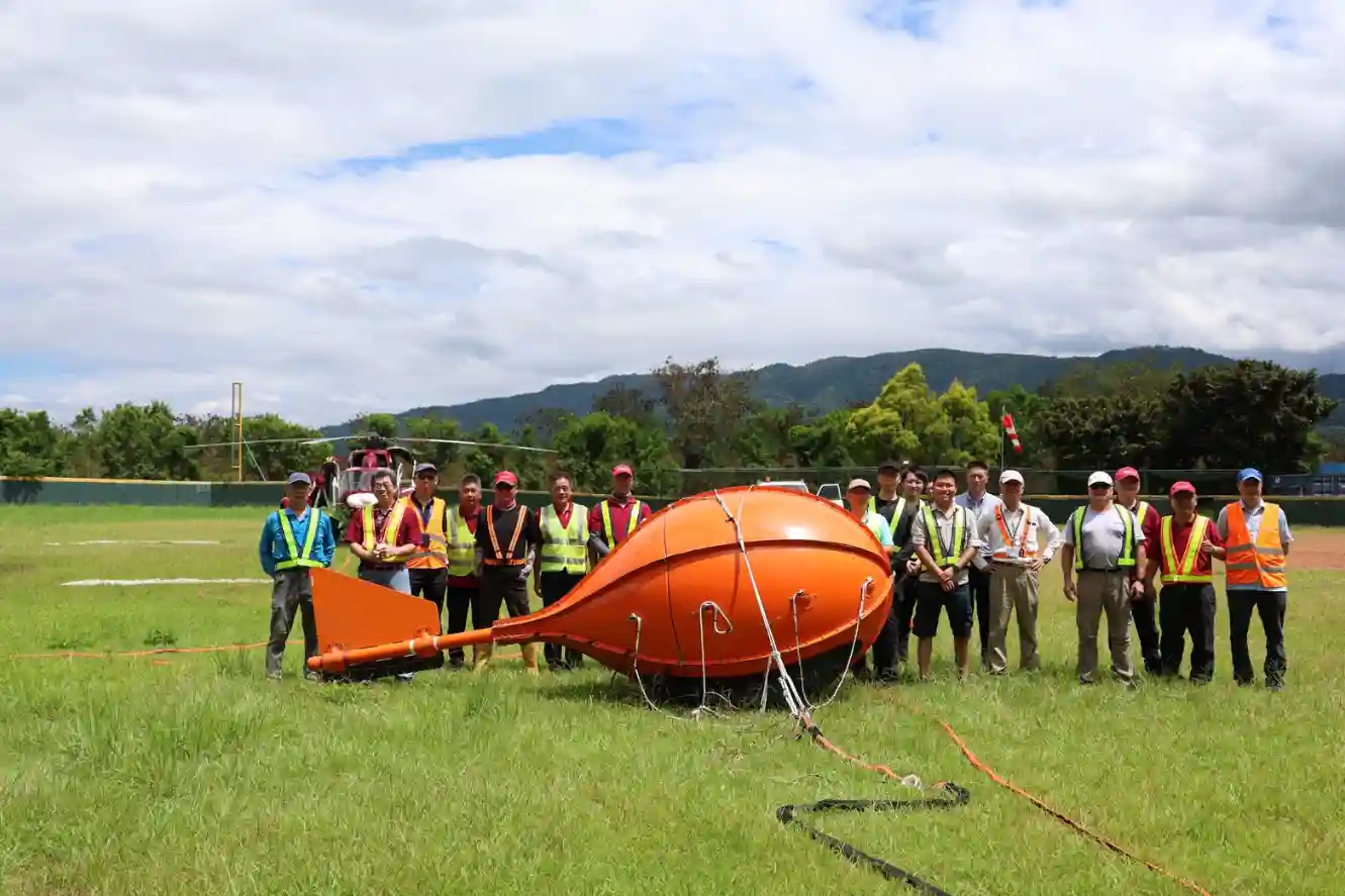
The nation's first MobileMT airborne magnetotelluric (AMT) survey project.
To enhance Taiwan's underground resource exploration capabilities, the Geological Survey and Mining Management Agency (GSMMA) under the Ministry of Economic Affairs, in collaboration with the Industrial Technology Research Institute (ITRI) and Daily Air Corporation, has launched Taiwan's first-ever MobileMT airborne magnetotelluric (AMT) survey project. The mission brings in a geothermal exploration and geophysics expert team from Canada, with extensive global experience in helicopter-based airborne surveys.
The upper and middle reaches of the Lanyang River in Yilan County have been assessed as the area with the greatest deep geothermal potential among Taiwan's top 10 geothermal zones. This project will conduct airborne surveys from early August in the Sanxing and Datong townships of Yilan. By leveraging this cutting-edge technology, the team aims to make groundbreaking progress in subsurface geological research, especially in geothermal resource detection.
"X-Ray Vision" for the Subsurface: Fast and Accurate Detection
According to GSMMA, this collaboration with foreign experts brings in one of the world's leading geophysical survey methods—airborne magnetotelluric technology. Its key advantage is the ability to rapidly and accurately acquire underground electrical structure data over large areas. For Taiwan, the introduction of this technology is of significant importance for underground resource exploration, particularly in advancing geothermal development.
The principle involves receiving naturally occurring electromagnetic waves from the Earth and simultaneously measuring changes in the electric field as these waves propagate underground. Since different geological structures, such as fault zones rich in geothermal fluids, highly permeable fractures, or rock layers containing conductive minerals, respond differently to electromagnetic waves, geophysicists can analyze the recorded data to generate subsurface resistivity distribution images. These images function like an "electrical" X-ray of the underground, revealing geological features at various depths and locations, helping identify geothermal reservoirs, fault zones, and other critical subsurface information.
The survey results will be published on the Geothermal Exploration Information Platform (GeoTEX), allowing the public and industry to access the latest data and jointly accelerate geothermal development.
Low-Altitude Helicopter Operations – Residents Advised Not to Approach
In this project, Daily Air's helicopters will carry specially designed MobileMT survey instruments in sling loads. The helicopter base will be at Yilan Sports Park, with flight operations focused on the Sanxing and Datong township areas. The airborne survey will run from August 6 to 12, with daily flight schedules adjusted according to weather conditions.
Due to the survey's requirement for low-altitude flights (around a few hundred meters) and the suspended instruments, residents may hear low-frequency noise and notice unusual devices in the air. GSMMA emphasizes that there is no need for alarm—this is a national-level geophysical survey project. All flight and survey operations follow strict standard procedures and have received the necessary approvals from the relevant authorities to ensure safety.
The public is asked to cooperate by avoiding the operation zones to ensure safety. GSMMA will continue working closely with its partners to ensure the successful completion of this airborne survey project, laying a solid foundation for Taiwan's underground resource exploration and geothermal energy development.
